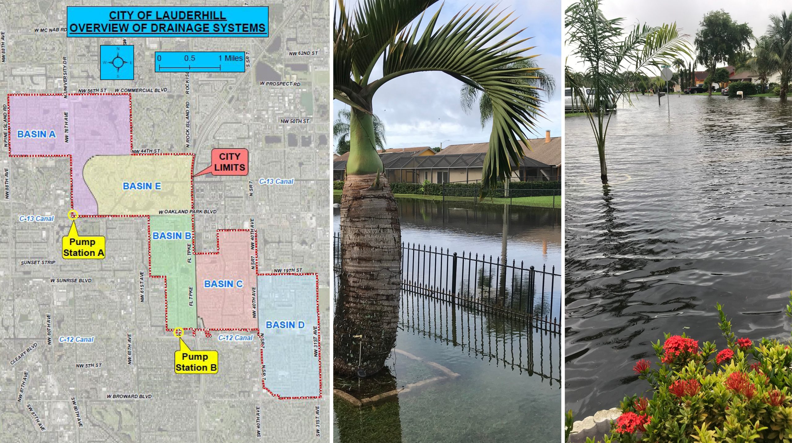
The City of Lauderhill retained BCC to develop a Stormwater Management and Flood Protection Master Plan to address current and future projected flooding conditions throughout the City. To assess the current and future flood protection level of service (FPLOS) of the City’s stormwater management infrastructure, BCC is developing a fully integrated one-dimensional (1D) and two-dimensional (2D) hydrologic/hydraulic (H&H) model for each of the five basins within the City. The software that will be utilized for this effort consists of Streamline Technologies Interconnected Channel and Pond Routing Model (ICPRv4).
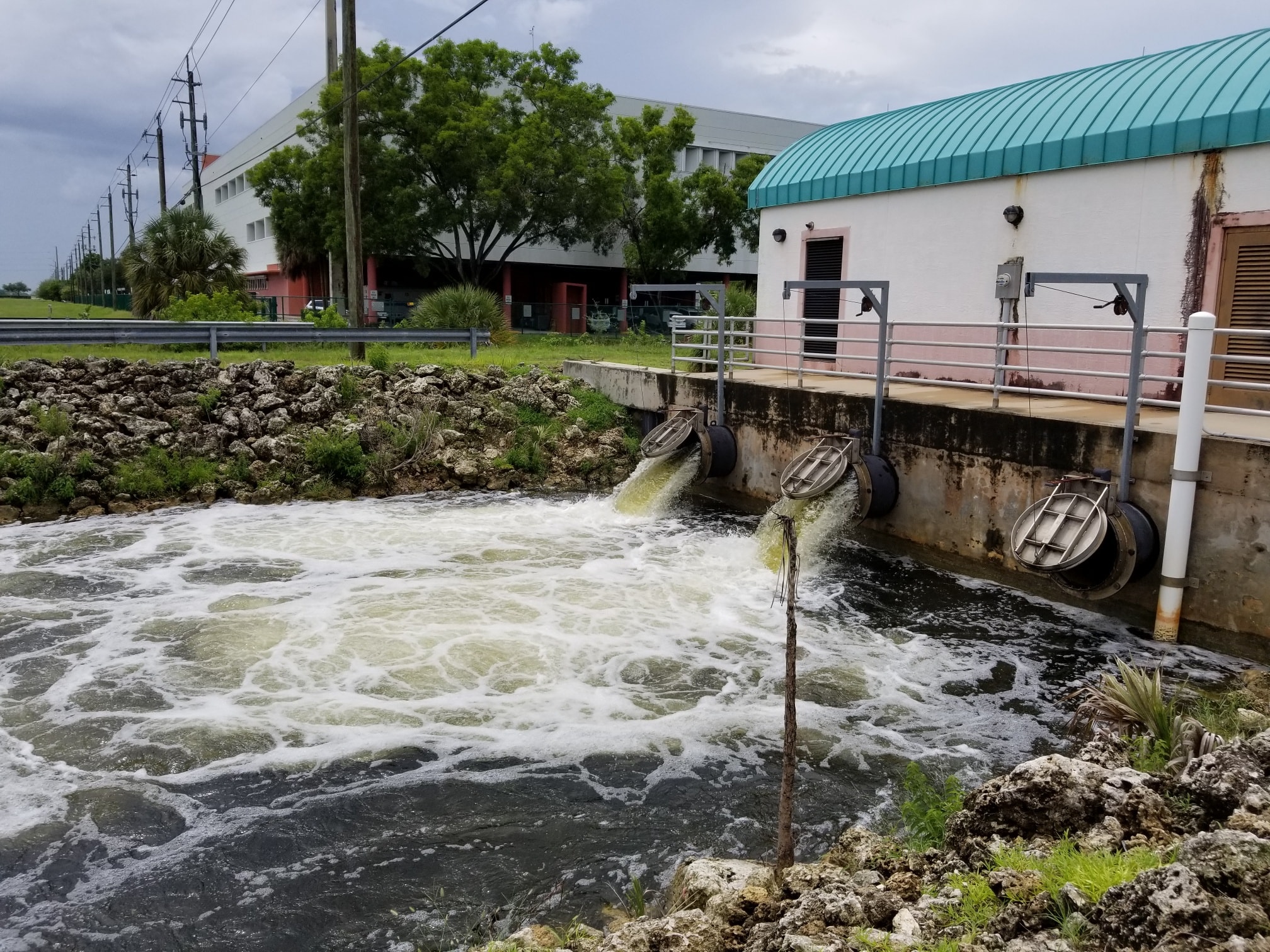
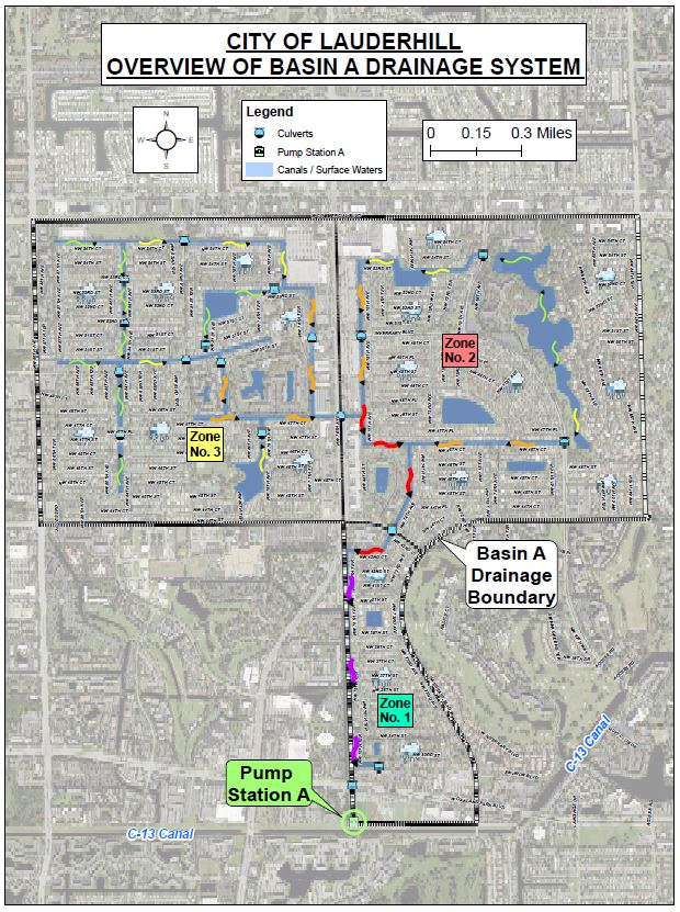
The models will represent and analyze all the drainage stormwater infrastructure within the City. This infrastructure consists of canals and lakes that are interconnected by culverts, bridges and control structures, which ultimately outfall the South Florida Water Management District’s C-12 (i.e., North Fork New River) and C-13 (i.e., Middle River) canals. The City’s drainage system also includes two stormwater pump stations: one for Basin A that discharges stormwater to the C-13 Canal and one for Basin B that discharges to the C-12 Canal. These canals originate near the conservation areas in the west and primarily flow in a westerly direction, prior to the discharging into the Bay to the east. The allowable discharge to and from these canals is regulated and limited to 90.6 and 75.9 cubic feet per second per square mile (CSM) for the C-12 and C-13 canal, respectively. It should be noted that these flow rates are based on SFWMD’s 25-year 72-hour design storm event. BCC is working with Broward County to establish boundary conditions for each of the basin models, using the available MIKESHE/MIKE 11 model developed by the County.
The key activities that are part of this Stormwater Management and Flood Protection Master Plan include:
- Data Collection and Evaluation
- Citywide Primary Culvert Assessment
- Existing Conditions Hydrologic/Hydraulic Model Development and Validation
- Stormwater Management and Flood Protection Project Formulation and Conceptual Design
- Stormwater Infrastructure Maintenance Plan Development
- Capital Improvement Plan Development
- Public Involvement and outreach
- Draft and Final Stormwater Management and Flood Protection Master Plan Report
- Existing stormwater pump station analysis Environment Resources Permit modification
- Develop 5-, 10- and 15-year Capital Improvement Plans
- Present Stormwater Master Plan to City Council for approval and adoption
The Stormwater Management and Flood Protection Master Plan will assist the City in:
- Providing 5-, 10- and 15-year stormwater Capital Improvement Plans (CIP) to implement high-priority stormwater improvement projects in a systematic, objective, and cost-effective manner.
- Securing grants for flood protection and water quality improvement projects
- Improving the City’s FEMA Community Rating Score (CRS) helping to reduce resident flood insurance rates.


The City of Lauderhill was established in 1959 and is located within the east-central portion of Broward County. The City covers a total area of approximately 8.5 square miles and is currently experiencing significant flooding conditions. Most of the flooding is being caused due to the more frequent and extreme rainfall events, aging stormwater management infrastructure, and further development throughout the City.
Services Provided:
Water Resources
Client:
City of Lauderhill
Location:
Broward County, Florida